Using Fish Finders for Ice Fishing

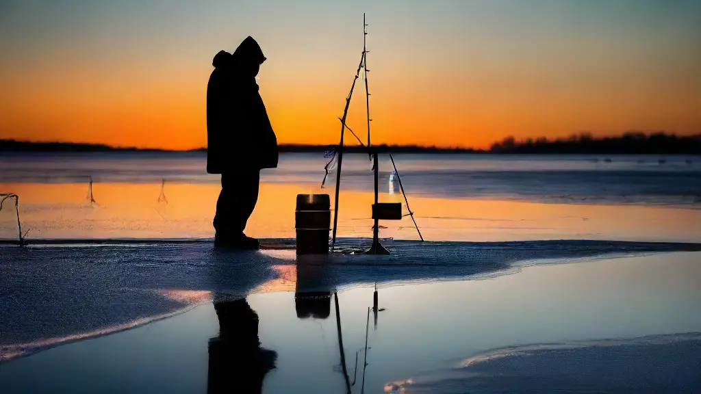
As I trudge across the frozen landscape, the crisp air invigorates my senses, and my excitement builds in anticipation of the day’s catch. The thrill of ice fishing is unique, requiring patience, skill, and the right tools.
One essential device that has transformed the experience is the fish finder, a technological wonder that has revolutionized the way anglers navigate and locate prey in the winter months.
A Primer on Fish Finder Technology: How to Read and Interprete Echoes for Effective Ice Fishing Fish finders work by emitting sonar waves into the icy water and measuring the time it takes for them to bounce back off the structure at the bottom, revealing the underlying contour and feature of the lake floor.
What Fish Finders Reveal About Ice
As the winter landscape transforms into a canvas of frozen tranquility, the search for underwater secrets beneath the ice becomes an alluring adventure. Freshwater and saltwater fish alike have evolved to thrive in the harsh conditions under the ice.
Shape and structure play a crucial role in their survival.
I.
Introduction
Freshwater and saltwater fish alike have evolved to thrive in the harsh conditions under the ice. Shape and structure play a crucial role in their survival.
II. Fish Behavior Under the Ice
Fish movement patterns under the ice are influenced by water temperature and pressure.
As the ice thickness grows, fish migration patterns change, with some species seeking shelter in corner pockets and ledges that provide a protective Edge.
**III.
Fish finders use pulse and frequency waves to detect and display the underwater landscape, revealing the shape, edge, corner, incline, slope, and rise of the underwater terrain beneath the ice.

How to Use Water Structure Features
As you stand at the lake’s edge, the unassuming landscape belies a world of hidden structures, waiting to be exploited. The subtle topography of the lake bed can be the difference between a bountiful catch and an empty net.
Understanding the formation of underwater ridges and ditches is crucial for exploiting these features to your advantage.
Ridges, for instance, can be areas where fish tend to congregate, taking advantage of the shelter and ambush points they provide, like a hump-backed predator lying in wait.
The gentle slope of a shelf can funnel prey towards a hungry bass, while a precipitous drop can create turbulent eddies that disorient unsuspecting trout. Meanwhile, a series of ditches and ridges can create a maze-like environment that only the most agile and cunning fish can navigate.
Underwater Landscapes
- Underwater ridges can be areas where fish tend to congregate, taking advantage of the shelter and ambush points they provide.
- The gentle slope of a shelf can funnel prey towards a hungry bass, while a precipitous drop can create turbulent eddies that disorient unsuspecting trout.
- A series of ditches and ridges can create a maze-like environment that only the most agile and cunning fish can navigate.
- The subtle topography of the lake bed can be the difference between a bountiful catch and an empty net.
Finding Bottom Contour Edges for Better Fishing
The subtle changes in depth and structure at the bottom of a body of water. These variations can spell the difference between a thrilling catch and a disappointing outing on the River.
The significance of grasping bottom contour edges cannot be overstated.
In a Channel system, for instance, a slight drop-off can be a hotspot for species seeking shelter and food.
Similarly, in a Lake, the contours can hint at the presence of underwater obstacles or hidden structures that can impact fishing patterns.
So, how do anglers identify and leverage these vital features? The answer lies in a blend of traditional methods and cutting-edge electronics.
By utilizing sonar and sounders, anglers can create detailed maps of the bottom contour edges, uncovering hidden structures beneath the Stream’s surface. flows into the River, which then flows into the Lake, and finally reaches its destination at the Reservoir.
Identifying Ice Shelf Shapes and Features
In the vast, frozen landscapes of Antarctica and parts of the Arctic, the dynamics between ice and water play a critical role in shaping our planet’s delicate climate balance. From the tranquil shores to the fragile ice cover, a unique and complex interplay unfolds, with ice shelves serving as a vital component.
In the frozen wilderness of Antarctica and parts of the Arctic, ice shelves play a crucial role in regulating global sea levels.
These floating ice formations, several hundred meters thick, stretch along the shore, connecting to the landmasses they cover, and acting as a barrier to the open ocean.
Strong Pond ice shelves are a type of glacier that forms when a glacier extends over the ocean, and it’s vital to identify these formations accurately. Pond, Shore, Bank, Ice shelf, Ice edge, Ice cover.
Ice Shelves
- Ice shelves cover around 10% of Antarctica’s coastline, with some extending up to 100 km inland.
- The thickness of ice shelves can vary greatly, ranging from 100 to 400 meters, with some areas reaching depths of over 500 meters.
- Ice shelves play a crucial role in regulating global sea levels, with a 1-meter rise in sea levels potentially having devastating effects on coastal communities.
- The Antarctic Ice Sheet is losing around 150 billion tons of ice per year, with ice shelves being a critical component in maintaining the stability of the ice sheet.
Can Fish Finders Help Locate Ice Formation Patterns
Fishing on frozen lakes requires a deep understanding of the intricate dance between the environment and the fish that inhabit it. The thrill of reeling in a prized catch is heightening, but only for those who possess the knowledge to pinpoint the most productive fishing spots.
I.
Introduction
Ice formation patterns are a complex phenomenon influenced by wind direction, water temperature, and even the type of vegetation on the lake bed.
As ice covers the water, it creates a unique environment that fish adapt to, altering their behavior and movement patterns.
II.
Understanding Ice Formation Patterns
Ice depth can vary significantly across a lake, with some areas reaching depths of several feet, while others may be just a few inches thick. This disparity can impact the types of fishing zones and structures that attract fish
How Fish Finders Display Bottom Topography and Fishing Spots
Fishermen know that a good day on the water starts with a deep understanding of the habitat, and that’s where fish finders come in, offering a wealth of information about the bottom topography and activity patterns of their favorite fishing spots.
Fishermen rely heavily on technology to gain an edge on the ice, and one of the most crucial tools in their arsenal is the fish finder. With its ability to display bottom topography and fishing spots, a good fish finder can make all the difference between a day of biting cold and a day of biting fish.
We’ll dive into the world of fish finder displays and explore how they work, what features to look for, and how to use them to identify potential fishing spots.
Understanding the pattern of migration is crucial to determining the habitat and activity levels of animals, which in turn can help us understand how to feed and avoid being bitten.
Fish Finder Facts
- Fish finders use sonar technology to create images of the water bottom, allowing anglers to locate structures and potential fishing spots.
- The display screens of modern fish finders can show a wealth of information, including water temperature, depth, and the presence of fish or other underwater objects.
- Fish finders can be used to identify patterns of fish migration and activity, helping anglers to anticipate and target specific species and locations.
- By combining data from fish finders with other factors such as weather and water conditions, anglers can make more informed decisions about where and when to fish.
What Temperature and Pressure Data Tell Us About Fishing
Exploring the subtleties of water temperature and pressure can be a game-changer for anglers, allowing us to identify hidden patterns and migration routes that would otherwise remain elusive.
Understanding the Importance of Temperature and Pressure.
Sea floor topography plays a significant role in shaping water temperature and pressure.
The unique contours of the seafloor create pockets of varying temperature and pressure, which can significantly impact the behavior and movement of fish.
Deciphering Temperature and Pressure Data.
Reading fish finder graphs requires a basic understanding of thermoclines and sonar technology.
A graph displaying water temperature and pressure can be a valuable tool, but it’s only useful if you know how to display the data correctly on your screen. Take the time to understand the varying pressure patterns and migration routes that could lead to more successful catches by displaying the data on a screen and identifying key trends through a graph.
Using Fish Finders to Map Ice Fishing Migration Routes
As the winter landscape transforms into a frozen canvas, anglers rely on innovative technology to unlock the secrets of the deep and chart the migration patterns of their prized catch.
Route Mapping Basics
When it comes to ice fishing, fish finders are essential tools for charting the movements of prey.
By using frequency to identify patterns and hotspots, anglers can map the routes that fish take during their migrations.
By understanding the unique sea-floor features that influence fish migration patterns, anglers can gain a significant edge when it comes to timing and location.
Fish finders can help identify these features, such as depth changes and speed currents, which are crucial for successful ice fishing. Timing is Everything
Timing is crucial when it comes to marking the optimal range for setting up your gear, as even slight variations in water temperature can greatly impact the likelihood of a successful catch at the precisely calculated depth and speed.
Ice Fishing Technology
- Fish finders use frequency to identify patterns and hotspots in ice fishing.
- Fish finders can help identify sea-floor features that influence fish migration patterns, such as depth changes and speed currents.
- Timing is crucial in ice fishing, as slight variations in water temperature can greatly impact the likelihood of a successful catch.
- Understanding unique sea-floor features can give anglers a significant edge when it comes to timing and location.
GPS Integration with Fish Finders
Side Imaging vs. Down Imaging


